 vesseltracker.com
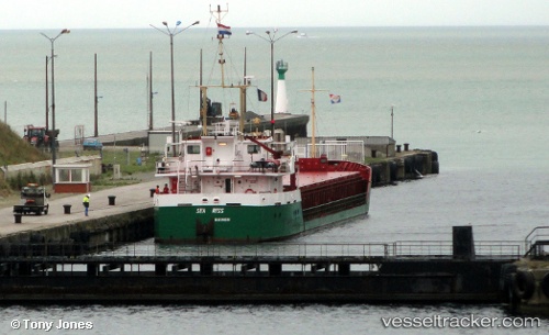
 Sea Riss
Current Status
Where is the vessel?
Sea Riss is currently in 17 nm NE of Krieschow, based on AIS data received less than 1h ago.
Latest AIS update:
Current position: 51.95719° N, 2.14047° E (17 nm NE of Krieschow)
Average speed (last 7 days): Loading…
Average speed (last 30 days): Loading…
Vessel profile: Sea Riss is a General Cargo Ship with dimensions 80m x 80m.
This page combines live AIS, route history, probable destination signals, nearby traffic, and port activity for practical vessel monitoring.
The current position of vessel Sea Riss is 51.95719 lat / 2.14047 lng. Updated: 2026-04-15 05:53:17 UTCNearest reference points:
- 11 nm NW of Krieschow
- 21 nm S of Craven Arms
- Near Oulton Broad
Currently sailing under the flag of Netherlands ![]()
Sea Riss built in 1992 year
Deadweight:
2200 tDetails:
Live Vessel Sea Riss Analytics (details, animations, etc.)
Recent AIS points (UTC):
2026-04-14 21:32:30 UTC · 51.03478, 2.26829 · SOG 0 kn · COG 1°2026-04-14 23:35:36 UTC · 51.06237, 2.25235 · SOG 7.6 kn · COG 268°
2026-04-15 03:30:38 UTC · 51.61964, 2.16635 · SOG 9.4 kn · COG 335°
2026-04-15 05:53:17 UTC · 51.95719, 2.14047 · SOG 7.7 kn · COG 348°