 vesseltracker.com
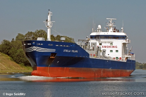
Vessel Stella Polaris IMO: 9187057, MMSI: 245911000 Chemical Oil Products Tanker
UTC, 51.48600, 1.17526, course: 94, speed: 12.4
UTC, 51.48188, 1.27205, course: 93, speed: 12.5
2026-01-14 03:30:25 UTC, 51.44897, 1.47225, course: 128, speed: 10.6
Live AIS position:
UTC. Near Broadstairs),
updated 2026-01-14 03:30:25 UTC.
Find the position of the vessel Stella Polaris on the map. The latter are known coordinates and path.
marine traffic ship tracker show on live map
The current position of vessel Stella Polaris is 51.44897 lat / 1.47225 lng. Updated: 2026-01-14 03:30:25 UTCCurrently sailing under the flag of Netherlands
Stella Polaris built in 1999 year
Deadweight:
8297 tDetails:
Last coordinates of the vessel:
UTC, 51.50210, 0.56061, course: 90, speed: 12.6UTC, 51.48600, 1.17526, course: 94, speed: 12.4
UTC, 51.48188, 1.27205, course: 93, speed: 12.5
2026-01-14 03:30:25 UTC, 51.44897, 1.47225, course: 128, speed: 10.6