 vesseltracker.com
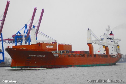
Vessel Suomigracht IMO: 9288057, MMSI: 246100000 Multi Purpose Carrier
UTC, 64.99793, 25.41866, course: 329, speed: 0
UTC, 64.99792, 25.41868, course: 329, speed: 0
2026-02-17 04:01:35 UTC, 64.99789, 25.41863, course: 329, speed: 0
Live AIS position:
UTC. Near Oulu (Uleåborg)),
updated 2026-02-17 04:01:35 UTC.
Find the position of the vessel Suomigracht on the map. The latter are known coordinates and path.
marine traffic ship tracker show on live map
The current position of vessel Suomigracht is 64.99789 lat / 25.41863 lng. Updated: 2026-02-17 04:01:35 UTCCurrently sailing under the flag of Netherlands
Suomigracht built in 2004 year
Deadweight:
23660 tDetails:
Last coordinates of the vessel:
UTC, 64.99787, 25.41865, course: 329, speed: 0UTC, 64.99793, 25.41866, course: 329, speed: 0
UTC, 64.99792, 25.41868, course: 329, speed: 0
2026-02-17 04:01:35 UTC, 64.99789, 25.41863, course: 329, speed: 0