 vesseltracker.com
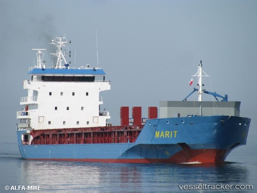
Vessel Marit IMO: 9364148, MMSI: 246127000 Multi Purpose Carrier
UTC, 51.69927, 4.61028, course: 340, speed: 0
UTC, 51.69929, 4.61032, course: 340, speed: 0
2026-03-10 20:12:11 UTC, 51.69927, 4.61036, course: 340, speed: 0
Live Vessel Marit Analytics (details, animations, etc.)
Live AIS position: UTC. Near MOERDIJK), updated 2026-03-10 20:12:11 UTC.Find the position of the vessel Marit on the map. The latter are known coordinates and path.
marine traffic ship tracker show on live map
The current position of vessel Marit is 51.69927 lat / 4.61036 lng. Updated: 2026-03-10 20:12:11 UTCCurrently sailing under the flag of Netherlands
Marit built in 2008 year
Deadweight:
7092 tDetails:
Last coordinates of the vessel:
UTC, 51.69931, 4.61036, course: 341, speed: 0UTC, 51.69927, 4.61028, course: 340, speed: 0
UTC, 51.69929, 4.61032, course: 340, speed: 0
2026-03-10 20:12:11 UTC, 51.69927, 4.61036, course: 340, speed: 0