 vesseltracker.com
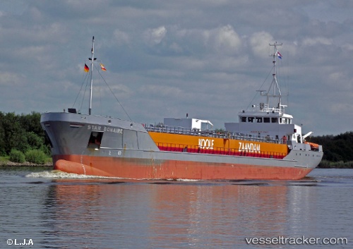
Vessel Star Bonaire IMO: 9148453, MMSI: 246359000 Edible Oil Tanker
UTC, 51.96860, 2.63012, course: 234, speed: 10.5
UTC, 51.71383, 2.06332, course: 229, speed: 8.9
2026-02-03 03:36:05 UTC, 51.61240, 1.82443, course: 244, speed: 10.2
Live AIS position:
UTC. Near Krieschow),
updated 2026-02-03 03:36:05 UTC.
Find the position of the vessel Star Bonaire on the map. The latter are known coordinates and path.
marine traffic ship tracker show on live map
The current position of vessel Star Bonaire is 51.61240 lat / 1.82443 lng. Updated: 2026-02-03 03:36:05 UTCCurrently sailing under the flag of Netherlands
Star Bonaire built in 1997 year
Deadweight:
3400 tDetails:
Last coordinates of the vessel:
UTC, 52.03883, 3.20265, course: 269, speed: 12.1UTC, 51.96860, 2.63012, course: 234, speed: 10.5
UTC, 51.71383, 2.06332, course: 229, speed: 8.9
2026-02-03 03:36:05 UTC, 51.61240, 1.82443, course: 244, speed: 10.2