 vesseltracker.com
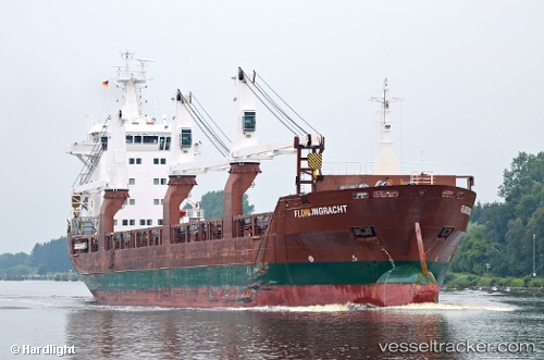
Vessel Florijngracht IMO: 9428413, MMSI: 246592000 General Cargo Ship
UTC, -33.00897, 151.79852, course: 42, speed: 0
UTC, -33.00713, 151.79848, course: 128, speed: 0.5
2026-02-25 15:43:52 UTC, -33.00653, 151.79890, course: 144, speed: 0
Live AIS position:
UTC. Near Redhead),
updated 2026-02-25 15:43:52 UTC.
Find the position of the vessel Florijngracht on the map. The latter are known coordinates and path.
marine traffic ship tracker show on live map
The current position of vessel Florijngracht is -33.00653 lat / 151.79890 lng. Updated: 2026-02-25 15:43:52 UTCCurrently sailing under the flag of Netherlands
Florijngracht built in 2010 year
Deadweight:
12500 tDetails:
Last coordinates of the vessel:
UTC, -33.00898, 151.79845, course: 45, speed: 0UTC, -33.00897, 151.79852, course: 42, speed: 0
UTC, -33.00713, 151.79848, course: 128, speed: 0.5
2026-02-25 15:43:52 UTC, -33.00653, 151.79890, course: 144, speed: 0