 vesseltracker.com
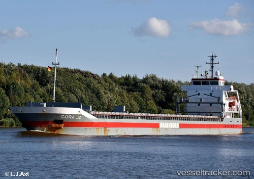
Vessel Cora Jo IMO: 9268875, MMSI: 246993000 General Cargo
UTC, 51.45396, 3.72061, course: 239, speed: 0
UTC, 51.45396, 3.72062, course: 239, speed: 0
2026-01-14 03:29:02 UTC, 51.45396, 3.72061, course: 239, speed: 0
Live AIS position:
UTC. Near Nieuwdorp),
updated 2026-01-14 03:29:02 UTC.
Find the position of the vessel Cora Jo on the map. The latter are known coordinates and path.
marine traffic ship tracker show on live map
The current position of vessel Cora Jo is 51.45396 lat / 3.72061 lng. Updated: 2026-01-14 03:29:02 UTCCurrently sailing under the flag of Netherlands
Cora Jo built in 2006 year
Deadweight:
6051 tDetails:
Last coordinates of the vessel:
UTC, 51.45394, 3.72062, course: 239, speed: 0UTC, 51.45396, 3.72061, course: 239, speed: 0
UTC, 51.45396, 3.72062, course: 239, speed: 0
2026-01-14 03:29:02 UTC, 51.45396, 3.72061, course: 239, speed: 0