 vesseltracker.com
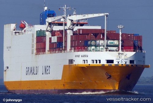
Grande Nigeria
Current StatusWhere is the vessel?
Grande Nigeria is currently in 30 nm S of Barrosso Terminal, based on AIS data received less than 1h ago.
Latest AIS update:
Current position: 24.27817° S, 45.57211° W (30 nm S of Barrosso Terminal)
Average speed (last 7 days): Loading…
Average speed (last 30 days): Loading…
Vessel profile: Grande Nigeria is a Vehicles Carrier with dimensions 32m x 214m.
This page combines live AIS, route history, probable destination signals, nearby traffic, and port activity for practical vessel monitoring.
The current position of vessel Grande Nigeria is -24.27817 lat / -45.57211 lng. Updated: 2026-04-07 21:25:29 UTCNearest reference points:
- 30 nm SE of Guarujá
- Near Barrosso Terminal
- 56 nm S of Sao Sebastiao
Details:
Live Vessel Grande Nigeria Analytics (details, animations, etc.)
Recent AIS points (UTC):
2026-04-07 16:02:15 UTC · -23.92835, -46.33302 · SOG 0 kn · COG 78°2026-04-07 17:37:15 UTC · -24.10982, -46.37927 · SOG 14.1 kn · COG 200°
2026-04-07 19:39:22 UTC · -24.26067, -46.03101 · SOG 14.5 kn · COG 94°
2026-04-07 21:25:29 UTC · -24.27817, -45.57211 · SOG 13.6 kn · COG 67°