 vesseltracker.com
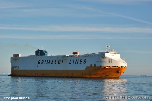
 Gran Bretagna
Current Status
Where is the vessel?
Gran Bretagna is currently in Near GEMLIK, based on AIS data received about 1h ago.
Latest AIS update:
Current position: 40.44015° N, 29.10035° E (Near GEMLIK)
Average speed (last 7 days): Loading…
Average speed (last 30 days): Loading…
Vessel profile: Gran Bretagna is a Vehicles Carrier with dimensions 184m x 32m.
This page combines live AIS, route history, probable destination signals, nearby traffic, and port activity for practical vessel monitoring.
The current position of vessel Gran Bretagna is 40.44015 lat / 29.10035 lng. Updated: 2026-04-08 17:46:07 UTCNearest reference points:
- Near GEMLIK
- 11 nm S of Maltepe
- 14 nm SW of Maltepe
Currently sailing under the flag of Italy ![]()
Gran Bretagna built in 1999 year
Deadweight:
18461 tDetails:
Live Vessel Gran Bretagna Analytics (details, animations, etc.)
Recent AIS points (UTC):
2026-04-08 12:20:56 UTC · 40.73233, 29.31601 · SOG 14.4 kn · COG 263°2026-04-08 13:58:14 UTC · 40.65197, 28.80329 · SOG 15.8 kn · COG 237°
2026-04-08 15:46:00 UTC · 40.43860, 28.89687 · SOG 11.1 kn · COG 84°
2026-04-08 17:46:07 UTC · 40.44015, 29.10035 · SOG 0.2 kn · COG 112°