 vesseltracker.com
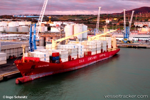
 Cala Palma
Current Status
Where is the vessel?
Cala Palma is currently in 10 nm SW of Plymouth, based on AIS data received about 1h ago.
Latest AIS update:
Current position: 16.55573° N, 62.31823° W (10 nm SW of Plymouth)
Average speed (last 7 days): Loading…
Average speed (last 30 days): Loading…
Vessel profile: Cala Palma is a Refrigerated Cargo Ship with dimensions 190m x 190m.
This page combines live AIS, route history, probable destination signals, nearby traffic, and port activity for practical vessel monitoring.
The current position of vessel Cala Palma is 16.55573 lat / -62.31823 lng. Updated: 2026-04-07 09:50:19 UTCNearest reference points:
- Near ANTIGUA
- Near Saint John's
- Near Pointe A Pitre
Currently sailing under the flag of Italy ![]()
Cala Palma built in 2000 year
Deadweight:
16024 tDetails:
Live Vessel Cala Palma Analytics (details, animations, etc.)
Recent AIS points (UTC):
2026-04-07 04:05:52 UTC · 17.35558, -60.77385 · SOG 17.8 kn · COG 237°2026-04-07 05:54:46 UTC · 17.07251, -61.24829 · SOG 17.7 kn · COG 237°
2026-04-07 07:51:39 UTC · 16.76964, -61.75119 · SOG 17.1 kn · COG 236°
2026-04-07 09:50:19 UTC · 16.55573, -62.31823 · SOG 17.4 kn · COG 249°