 vesseltracker.com
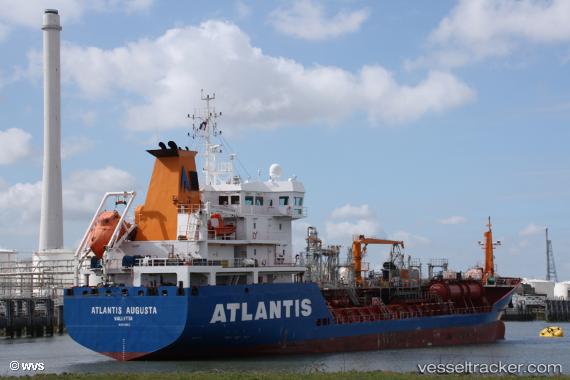
 Atlantis Augusta
Current Status
Where is the vessel?
Atlantis Augusta is currently in 34 nm NE of Colne, based on AIS data received about 18h ago.
Latest AIS update:
Current position: 55.65333° N, 1.03667° E (34 nm NE of Colne)
Average speed (last 7 days): Loading…
Average speed (last 30 days): Loading…
Vessel profile: Atlantis Augusta is a Oil Products Tanker with dimensions 105m x 17m.
This page combines live AIS, route history, probable destination signals, nearby traffic, and port activity for practical vessel monitoring.
The current position of vessel Atlantis Augusta is 55.65333 lat / 1.03667 lng. Updated: 2026-04-10 06:56:13 UTCNearest reference points:
- 19 nm W of Curlew
- 28 nm N of Weaverthorpe
- Near Flamborough
Currently sailing under the flag of Malta ![]()
Details:
Live Vessel Atlantis Augusta Analytics (details, animations, etc.)
Recent AIS points (UTC):
2026-04-10 02:23:13 UTC · 55.31833, 0.14167 · SOG 8 kn · COG -1°2026-04-10 03:47:11 UTC · 55.44833, 0.38667 · SOG 8 kn · COG -1°
2026-04-10 05:47:11 UTC · 55.60333, 0.77833 · SOG 8 kn · COG -1°
2026-04-10 06:56:13 UTC · 55.65333, 1.03667 · SOG 8 kn · COG -1°