 vesseltracker.com
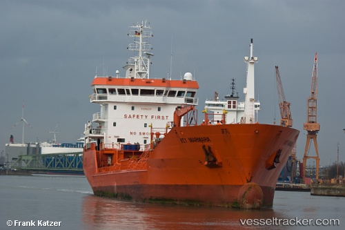
Vessel Key Marmara IMO: 9268239, MMSI: 248891000 Chemical Oil Products Tanker
UTC, 66.68541, 12.16586, course: 75, speed: 12.3
UTC, 66.74576, 13.40534, course: 83, speed: 12.6
2026-01-30 05:56:37 UTC, 66.74555, 13.49845, course: 269, speed: 0
Live AIS position:
UTC. Near Forøy),
updated 2026-01-30 05:56:37 UTC.
Find the position of the vessel Key Marmara on the map. The latter are known coordinates and path.
marine traffic ship tracker show on live map
The current position of vessel Key Marmara is 66.74555 lat / 13.49845 lng. Updated: 2026-01-30 05:56:37 UTCDetails:
Last coordinates of the vessel:
UTC, 66.44234, 11.24672, course: 20, speed: 12.3UTC, 66.68541, 12.16586, course: 75, speed: 12.3
UTC, 66.74576, 13.40534, course: 83, speed: 12.6
2026-01-30 05:56:37 UTC, 66.74555, 13.49845, course: 269, speed: 0