 vesseltracker.com
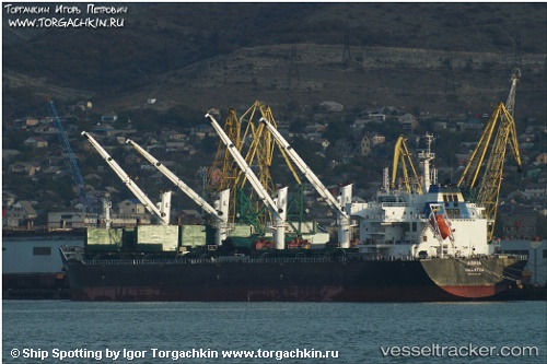
Vessel Agria IMO: 9584140, MMSI: 248914000 Bulk Carrier
UTC, -5.91992, 105.99517, course: 45, speed: 0
UTC, -5.91990, 105.99517, course: 45, speed: 0
2026-02-01 16:19:58 UTC, -5.91995, 105.99526, course: 45, speed: 0
Live AIS position:
UTC. Near MERAK),
updated 2026-02-01 16:19:58 UTC.
Find the position of the vessel Agria on the map. The latter are known coordinates and path.
marine traffic ship tracker show on live map
The current position of vessel Agria is -5.91995 lat / 105.99526 lng. Updated: 2026-02-01 16:19:58 UTCCurrently sailing under the flag of Malta
Agria built in 2011 year
Deadweight:
56805 tDetails:
Last coordinates of the vessel:
UTC, -5.91833, 105.99500, course: -1, speed: 0UTC, -5.91992, 105.99517, course: 45, speed: 0
UTC, -5.91990, 105.99517, course: 45, speed: 0
2026-02-01 16:19:58 UTC, -5.91995, 105.99526, course: 45, speed: 0