 vesseltracker.com
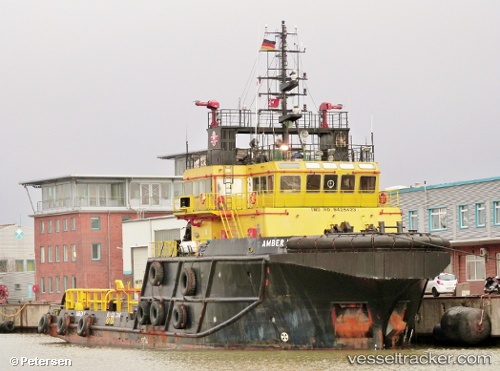
Vessel Amber Ii IMO: 9425423, MMSI: 249122000 Offshore Support Vessel
UTC, 51.90566, 4.43231, course: 233, speed: 0
UTC, 51.90568, 4.43229, course: 233, speed: 0
2026-01-28 03:59:08 UTC, 51.90560, 4.43225, course: 233, speed: 0
Live AIS position:
UTC. Near DELFSHAVEN),
updated 2026-01-28 03:59:08 UTC.
Find the position of the vessel Amber Ii on the map. The latter are known coordinates and path.
marine traffic ship tracker show on live map
The current position of vessel Amber Ii is 51.90560 lat / 4.43225 lng. Updated: 2026-01-28 03:59:08 UTCCurrently sailing under the flag of Malta
Amber Ii built in 2007 year
Deadweight:
760 tDetails:
Last coordinates of the vessel:
UTC, 51.90564, 4.43231, course: 233, speed: 0UTC, 51.90566, 4.43231, course: 233, speed: 0
UTC, 51.90568, 4.43229, course: 233, speed: 0
2026-01-28 03:59:08 UTC, 51.90560, 4.43225, course: 233, speed: 0