 vesseltracker.com
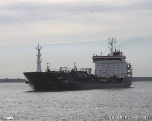
Vessel Hulin IMO: 9447043, MMSI: 249437000 Chemical Oil Products Tanker
UTC, 54.35718, 9.78046, course: 233, speed: 6.7
UTC, 54.17817, 9.46283, course: 251, speed: 6.9
2026-02-10 05:45:56 UTC, 54.01111, 9.29610, course: 190, speed: 6.8
Live AIS position:
UTC. Near Brickeln),
updated 2026-02-10 05:45:56 UTC.
Find the position of the vessel Hulin on the map. The latter are known coordinates and path.
marine traffic ship tracker show on live map
The current position of vessel Hulin is 54.01111 lat / 9.29610 lng. Updated: 2026-02-10 05:45:56 UTCCurrently sailing under the flag of Malta
Hulin built in 2008 year
Deadweight:
10744 tDetails:
Last coordinates of the vessel:
UTC, 54.34167, 9.95400, course: 261, speed: 4.9UTC, 54.35718, 9.78046, course: 233, speed: 6.7
UTC, 54.17817, 9.46283, course: 251, speed: 6.9
2026-02-10 05:45:56 UTC, 54.01111, 9.29610, course: 190, speed: 6.8