 vesseltracker.com
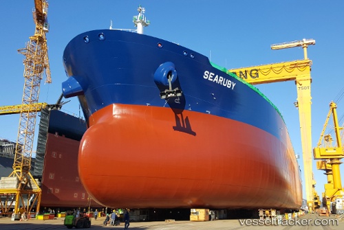
Vessel Searuby IMO: 9759795, MMSI: 249693000 Crude Oil Tanker
UTC, 10.51082, -71.60805, course: 43, speed: 0
UTC, 10.51081, -71.60809, course: 44, speed: 0
2026-02-05 18:10:54 UTC, 10.51083, -71.60808, course: 43, speed: 0
Live AIS position:
UTC. Near Chiquinquirá),
updated 2026-02-05 18:10:54 UTC.
Find the position of the vessel Searuby on the map. The latter are known coordinates and path.
marine traffic ship tracker show on live map
The current position of vessel Searuby is 10.51083 lat / -71.60808 lng. Updated: 2026-02-05 18:10:54 UTCDetails:
Last coordinates of the vessel:
UTC, 10.51080, -71.60806, course: 43, speed: 0UTC, 10.51082, -71.60805, course: 43, speed: 0
UTC, 10.51081, -71.60809, course: 44, speed: 0
2026-02-05 18:10:54 UTC, 10.51083, -71.60808, course: 43, speed: 0