 vesseltracker.com
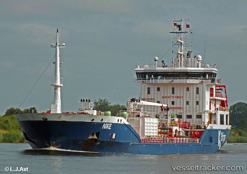
 Nike
Nike
Current Status
Where is the vessel?
Nike is currently in Near Saint-Martin-du-Manoir, based on AIS data received about 1h ago.
Latest AIS update:
Current position: 49.47631° N, 0.12769° W (Near Saint-Martin-du-Manoir)
Average speed (last 7 days): Loading…
Average speed (last 30 days): Loading…
Vessel profile: Nike is a Chemical Oil Products Tanker with dimensions 122m x 17m.
This page combines live AIS, route history, probable destination signals, nearby traffic, and port activity for practical vessel monitoring.
The current position of vessel Nike is 49.47631 lat / -0.12769 lng. Updated: 2026-04-02 10:10:28 UTCNearest reference points:
- Near Le Havre
- Near TROUVILLE-SUR-MER
- Near Caen
Currently sailing under the flag of Malta ![]()
Nike built in 2009 year
Deadweight:
7770 tDetails:
Live Vessel Nike Analytics (details, animations, etc.)
Recent AIS points (UTC):
2026-04-02 03:40:25 UTC · 49.47595, -0.13108 · SOG 0.1 kn · COG 57°2026-04-02 05:46:29 UTC · 49.47510, -0.13061 · SOG 0.1 kn · COG 24°
2026-04-02 07:58:27 UTC · 49.47642, -0.12772 · SOG 0 kn · COG 274°
2026-04-02 10:10:28 UTC · 49.47631, -0.12769 · SOG 0.1 kn · COG 293°