 vesseltracker.com
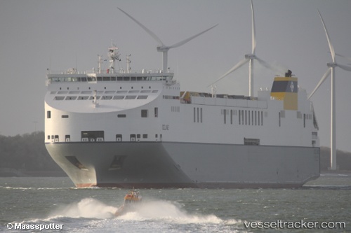
 Celine
Current Status
Where is the vessel?
Celine is currently in 40 nm E of Claonaig, based on AIS data received about 1d ago.
Latest AIS update:
Current position: 55.59399° N, 6.54027° E (40 nm E of Claonaig)
Average speed (last 7 days): Loading…
Average speed (last 30 days): Loading…
Vessel profile: Celine is a Ro Ro Cargo Ship with dimensions 234m x 38m.
This page combines live AIS, route history, probable destination signals, nearby traffic, and port activity for practical vessel monitoring.
The current position of vessel Celine is 55.59399 lat / 6.54027 lng. Updated: 2026-04-10 07:21:29 UTCNearest reference points:
- 36 nm W of HVIDE SANDE
- Near Blavand
- Near Basel
Currently sailing under the flag of Malta ![]()
Details:
Live Vessel Celine Analytics (details, animations, etc.)
Recent AIS points (UTC):
2026-04-10 02:24:03 UTC · 56.78982, 7.60738 · SOG 16.7 kn · COG 216°2026-04-10 03:49:24 UTC · 56.45587, 7.29611 · SOG 16.2 kn · COG 200°
2026-04-10 05:58:05 UTC · 55.92141, 6.87817 · SOG 16.5 kn · COG 212°
2026-04-10 07:21:29 UTC · 55.59399, 6.54027 · SOG 16.7 kn · COG 214°