 vesseltracker.com
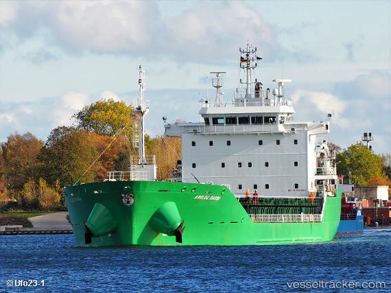
Vessel Arklow Marsh IMO: 9440253, MMSI: 250002012 General Cargo Ship
UTC, 51.17499, 3.79944, course: -1, speed: 0.8
UTC, 51.17400, 3.79933, course: -1, speed: 0.1
2026-03-04 02:18:41 UTC, 51.17400, 3.79934, course: -1, speed: 0
Live AIS position:
UTC. Near Rieme),
updated 2026-03-04 02:18:41 UTC.
Find the position of the vessel Arklow Marsh on the map. The latter are known coordinates and path.
marine traffic ship tracker show on live map
The current position of vessel Arklow Marsh is 51.17400 lat / 3.79934 lng. Updated: 2026-03-04 02:18:41 UTCCurrently sailing under the flag of Ireland
Arklow Marsh built in 2010 year
Deadweight:
14990 tDetails:
Last coordinates of the vessel:
UTC, 51.13045, 3.77077, course: 217, speed: 0UTC, 51.17499, 3.79944, course: -1, speed: 0.8
UTC, 51.17400, 3.79933, course: -1, speed: 0.1
2026-03-04 02:18:41 UTC, 51.17400, 3.79934, course: -1, speed: 0