 vesseltracker.com
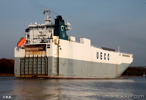
 Autostar
Current Status
Where is the vessel?
Autostar is currently in Near Wangerooge, based on AIS data received less than 1h ago.
Latest AIS update:
Current position: 53.96108° N, 7.91392° E (Near Wangerooge)
Average speed (last 7 days): Loading…
Average speed (last 30 days): Loading…
Vessel profile: Autostar is a Vehicles Carrier with dimensions 140m x 23m.
This page combines live AIS, route history, probable destination signals, nearby traffic, and port activity for practical vessel monitoring.
The current position of vessel Autostar is 53.96108 lat / 7.91392 lng. Updated: 2026-04-15 05:53:31 UTCNearest reference points:
- Near Wangerooge
- Near Helgoland
- 10 nm E of Wangerooge
Currently sailing under the flag of Portugal ![]()
Autostar built in 2000 year
Deadweight:
6670 tDetails:
Live Vessel Autostar Analytics (details, animations, etc.)
Recent AIS points (UTC):
2026-04-14 21:34:26 UTC · 53.20588, 4.55478 · SOG 16.6 kn · COG 31°2026-04-14 23:35:33 UTC · 53.52043, 5.25756 · SOG 16.4 kn · COG 72°
2026-04-15 03:30:38 UTC · 53.82324, 6.97376 · SOG 16.4 kn · COG 78°
2026-04-15 05:53:31 UTC · 53.96108, 7.91392 · SOG 8.9 kn · COG 76°