 vesseltracker.com
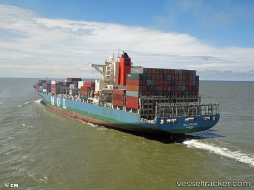
 Mol Garland
Current Status
Where is the vessel?
Mol Garland is currently in Near Tips Container Terminal, based on AIS data received less than 1h ago.
Latest AIS update:
Current position: 13.06666° N, 100.89580° E (Near Tips Container Terminal)
Average speed (last 7 days): Loading…
Average speed (last 30 days): Loading…
Vessel profile: Mol Garland is a Container Ship with dimensions 275m x 275m.
This page combines live AIS, route history, probable destination signals, nearby traffic, and port activity for practical vessel monitoring.
The current position of vessel Mol Garland is 13.06666 lat / 100.89580 lng. Updated: 2026-04-22 01:58:49 UTCNearest reference points:
- Near Tips Container Terminal
- Near Sriracha
- Near SIRACHA
Currently sailing under the flag of Portugal ![]()
Mol Garland built in 2011 year
Deadweight:
71409 tDetails:
Live Vessel Mol Garland Analytics (details, animations, etc.)
Recent AIS points (UTC):
2026-04-21 22:01:46 UTC · 13.06665, 100.89580 · SOG 0 kn · COG 60°2026-04-22 00:10:56 UTC · 13.06665, 100.89580 · SOG 0 kn · COG 60°
2026-04-22 01:31:54 UTC · 13.06664, 100.89581 · SOG 0 kn · COG 60°
2026-04-22 01:58:49 UTC · 13.06666, 100.89580 · SOG 0 kn · COG 60°