 vesseltracker.com
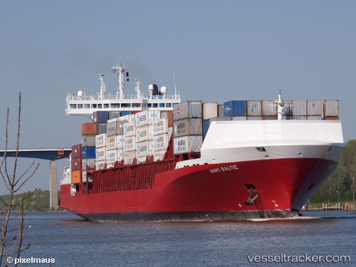
Vessel Navi Baltic IMO: 9386718, MMSI: 255805884 Container Ship
UTC, 53.54840, 9.83362, course: 107, speed: 8
UTC, 53.53144, 9.91046, course: 304, speed: 0
2026-02-28 19:29:42 UTC, 53.53148, 9.91042, course: -1, speed: 0
Live AIS position:
UTC. Near Altenwerder),
updated 2026-02-28 19:29:42 UTC.
Find the position of the vessel Navi Baltic on the map. The latter are known coordinates and path.
marine traffic ship tracker show on live map
The current position of vessel Navi Baltic is 53.53148 lat / 9.91042 lng. Updated: 2026-02-28 19:29:42 UTCCurrently sailing under the flag of Portugal
Navi Baltic built in 2009 year
Deadweight:
17894 tDetails:
Last coordinates of the vessel:
UTC, 53.68709, 9.50000, course: 165, speed: 11.1UTC, 53.54840, 9.83362, course: 107, speed: 8
UTC, 53.53144, 9.91046, course: 304, speed: 0
2026-02-28 19:29:42 UTC, 53.53148, 9.91042, course: -1, speed: 0