 vesseltracker.com
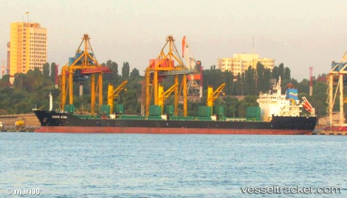
Vessel SIDER KING IMO: 9615913, MMSI: 255806375 General Cargo Ship
UTC, 51.45927, -3.15178, course: 36, speed: 0
UTC, 51.45929, -3.15178, course: 36, speed: 0
2026-02-21 11:22:04 UTC, 51.45928, -3.15175, course: 36, speed: 0
Live AIS position:
UTC. Near Cardiff),
updated 2026-02-21 11:22:04 UTC.
Find the position of the vessel SIDER KING on the map. The latter are known coordinates and path.
marine traffic ship tracker show on live map
The current position of vessel SIDER KING is 51.45928 lat / -3.15175 lng. Updated: 2026-02-21 11:22:04 UTCCurrently sailing under the flag of Portugal (MAR)
SIDER KING built in 2011 year
Deadweight:
25467 tDetails:
Last coordinates of the vessel:
UTC, 51.45927, -3.15181, course: 36, speed: 0UTC, 51.45927, -3.15178, course: 36, speed: 0
UTC, 51.45929, -3.15178, course: 36, speed: 0
2026-02-21 11:22:04 UTC, 51.45928, -3.15175, course: 36, speed: 0