 vesseltracker.com
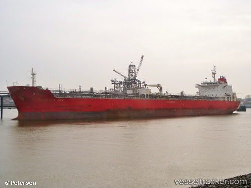
Vessel PORTARIA IMO: 9464326, MMSI: 256077000 Chemical/Oil Products Tanker
UTC, 27.97139, -15.37923, course: 85, speed: 0
UTC, 27.97136, -15.37930, course: 85, speed: 0
2026-02-10 03:56:46 UTC, 27.97139, -15.37930, course: 84, speed: 0.3
Live AIS position:
UTC. Near PUERTO DE SALINETAS),
updated 2026-02-10 03:56:46 UTC.
Find the position of the vessel PORTARIA on the map. The latter are known coordinates and path.
marine traffic ship tracker show on live map
The current position of vessel PORTARIA is 27.97139 lat / -15.37930 lng. Updated: 2026-02-10 03:56:46 UTCCurrently sailing under the flag of Malta
PORTARIA built in 2010 year
Deadweight:
36686 tDetails:
Last coordinates of the vessel:
UTC, 27.97139, -15.37927, course: 84, speed: 0.2UTC, 27.97139, -15.37923, course: 85, speed: 0
UTC, 27.97136, -15.37930, course: 85, speed: 0
2026-02-10 03:56:46 UTC, 27.97139, -15.37930, course: 84, speed: 0.3