 vesseltracker.com
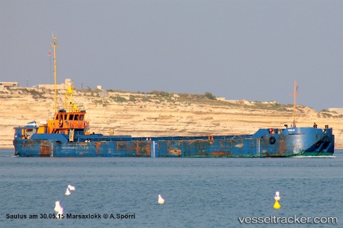
Saulus
Current StatusWhere is the vessel?
Saulus is currently in Near Sliema, based on AIS data received less than 1h ago.
Latest AIS update:
Current position: 35.88571° N, 14.50401° E (Near Sliema)
Average speed (last 7 days): Loading…
Average speed (last 30 days): Loading…
Vessel profile: Saulus is a Service Ship with dimensions 10m x 59m.
This page combines live AIS, route history, probable destination signals, nearby traffic, and port activity for practical vessel monitoring.
The current position of vessel Saulus is 35.88571 lat / 14.50401 lng. Updated: 2026-04-23 04:41:41 UTCNearest reference points:
- Near Sliema
- Near Floriana
- Near Valletta
Details:
Live Vessel Saulus Analytics (details, animations, etc.)
Recent AIS points (UTC):
2026-04-23 00:14:36 UTC · 35.88678, 14.50502 · SOG 0 kn · COG 47°2026-04-23 01:08:41 UTC · 35.88678, 14.50502 · SOG 0 kn · COG 47°
2026-04-23 03:29:38 UTC · 35.88678, 14.50503 · SOG 0 kn · COG 45°
2026-04-23 04:41:41 UTC · 35.88571, 14.50401 · SOG 1.4 kn · COG 45°