 vesseltracker.com
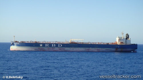
Vessel SEALEO IMO: 9473066, MMSI: 256721000 Crude Oil Tanker
UTC, 10.51079, -71.60814, course: -1, speed: 0
UTC, 10.51079, -71.60814, course: -1, speed: 0
2026-02-27 17:14:14 UTC, 10.51079, -71.60814, course: -1, speed: 0
Live AIS position:
UTC. Near Chiquinquirá),
updated 2026-02-27 17:14:14 UTC.
Find the position of the vessel SEALEO on the map. The latter are known coordinates and path.
marine traffic ship tracker show on live map
The current position of vessel SEALEO is 10.51079 lat / -71.60814 lng. Updated: 2026-02-27 17:14:14 UTCCurrently sailing under the flag of Malta
SEALEO built in 2012 year
Deadweight:
107505 tDetails:
Last coordinates of the vessel:
UTC, 10.51077, -71.60816, course: -1, speed: 0UTC, 10.51079, -71.60814, course: -1, speed: 0
UTC, 10.51079, -71.60814, course: -1, speed: 0
2026-02-27 17:14:14 UTC, 10.51079, -71.60814, course: -1, speed: 0