 vesseltracker.com
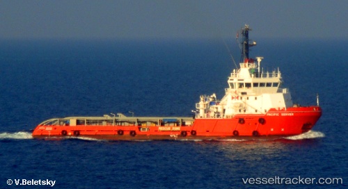
 Steyer
Current Status
Where is the vessel?
Steyer is currently in 34 nm SW of Skudeneshavn, based on AIS data received about 1d ago.
Latest AIS update:
Current position: 58.75967° N, 4.42720° E (34 nm SW of Skudeneshavn)
Average speed (last 7 days): Loading…
Average speed (last 30 days): Loading…
Vessel profile: Steyer is a Offshore Tug Supply Ship with dimensions 58m x 15m.
This page combines live AIS, route history, probable destination signals, nearby traffic, and port activity for practical vessel monitoring.
The current position of vessel Steyer is 58.75967 lat / 4.42720 lng. Updated: 2026-04-10 07:25:57 UTCNearest reference points:
- Near Storøya
- Near HUSOYA
- Near Lura
Currently sailing under the flag of Norway ![]()
Details:
Live Vessel Steyer Analytics (details, animations, etc.)
Recent AIS points (UTC):
2026-04-10 02:20:18 UTC · 58.43821, 4.12745 · SOG 5.2 kn · COG 22°2026-04-10 03:47:45 UTC · 58.56770, 4.15220 · SOG 5.9 kn · COG 20°
2026-04-10 05:57:16 UTC · 58.65687, 4.35280 · SOG 4.1 kn · COG 102°
2026-04-10 07:25:57 UTC · 58.75967, 4.42720 · SOG 4.8 kn · COG 11°