 vesseltracker.com
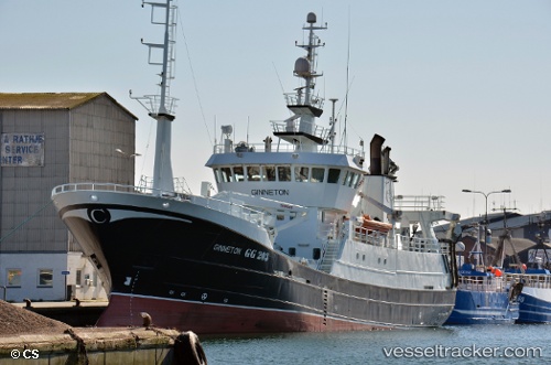
 Straumbas
Current Status
Where is the vessel?
Straumbas is currently in Near OLEN, based on AIS data received less than 1h ago.
Latest AIS update:
Current position: 59.60686° N, 5.76900° E (Near OLEN)
Average speed (last 7 days): Loading…
Average speed (last 30 days): Loading…
Vessel profile: Straumbas is a Fish Carrier with dimensions 49m x 10m.
This page combines live AIS, route history, probable destination signals, nearby traffic, and port activity for practical vessel monitoring.
The current position of vessel Straumbas is 59.60686 lat / 5.76900 lng. Updated: 2026-03-31 11:56:44 UTCNearest reference points:
- Near Halsnøy
- Near Valevåg
- Near ROSENDAL
Currently sailing under the flag of Norway ![]()
Straumbas built in 1998 year
Details:
Live Vessel Straumbas Analytics (details, animations, etc.)
Recent AIS points (UTC):
2026-03-31 06:15:34 UTC · 59.60691, 5.76894 · SOG 0 kn · COG 318°2026-03-31 07:18:14 UTC · 59.60696, 5.76896 · SOG 0 kn · COG 323°
2026-03-31 09:41:54 UTC · 59.60699, 5.76893 · SOG 0 kn · COG 323°
2026-03-31 11:56:44 UTC · 59.60686, 5.76900 · SOG 0 kn · COG 323°