 vesseltracker.com
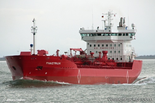
Vessel Finnstraum IMO: 9172222, MMSI: 257409000 Chemical Oil Products Tanker
UTC, 53.62285, 5.33420, course: 250, speed: 10.2
UTC, 53.58654, 5.15079, course: 248, speed: 10.2
2026-01-15 05:53:14 UTC, 53.42788, 4.59627, course: 202, speed: 10.7
Live AIS position:
UTC. Near Hijum),
updated 2026-01-15 05:53:14 UTC.
Find the position of the vessel Finnstraum on the map. The latter are known coordinates and path.
marine traffic ship tracker show on live map
The current position of vessel Finnstraum is 53.42788 lat / 4.59627 lng. Updated: 2026-01-15 05:53:14 UTCCurrently sailing under the flag of Norway
Finnstraum built in 1999 year
Deadweight:
16028 tDetails:
Last coordinates of the vessel:
UTC, 53.76844, 6.12406, course: 256, speed: 12.7UTC, 53.62285, 5.33420, course: 250, speed: 10.2
UTC, 53.58654, 5.15079, course: 248, speed: 10.2
2026-01-15 05:53:14 UTC, 53.42788, 4.59627, course: 202, speed: 10.7