 vesseltracker.com
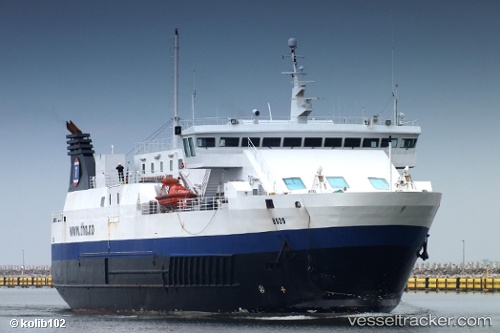
Bodo
Current StatusWhere is the vessel?
Bodo is currently in Near BODOE, based on AIS data received less than 1h ago.
Latest AIS update:
Current position: 67.29214° N, 14.39814° E (Near BODOE)
Average speed (last 7 days): Loading…
Average speed (last 30 days): Loading…
Vessel profile: Bodo is a Passenger Ro Ro Cargo Ship with dimensions 18m x 80m.
This page combines live AIS, route history, probable destination signals, nearby traffic, and port activity for practical vessel monitoring.
The current position of vessel Bodo is 67.29214 lat / 14.39814 lng. Updated: 2026-04-10 07:23:44 UTCNearest reference points:
- Near Misten
- Near SVOLVAER
- Near Ørnes
Details:
Live Vessel Bodo Analytics (details, animations, etc.)
Recent AIS points (UTC):
2026-04-10 02:20:44 UTC · 67.29214, 14.39817 · SOG 0 kn · COG 202°2026-04-10 03:47:40 UTC · 67.29215, 14.39818 · SOG 0 kn · COG 202°
2026-04-10 05:59:49 UTC · 67.29215, 14.39820 · SOG 0 kn · COG 202°
2026-04-10 07:23:44 UTC · 67.29214, 14.39814 · SOG 0 kn · COG 203°