 vesseltracker.com
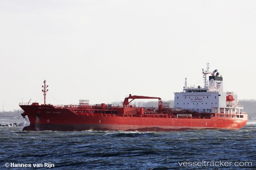
Vessel LOEVSTAKKEN IMO: 9724441, MMSI: 258050000 Chemical/Oil Products Tanker
UTC, 51.87985, 4.30101, course: 72, speed: 0.2
UTC, 51.87984, 4.30105, course: 72, speed: 0.1
2026-02-11 12:08:54 UTC, 51.87985, 4.30101, course: 72, speed: 0.1
Live AIS position:
UTC. Near BOTLEK - ROTTERDAM),
updated 2026-02-11 12:08:54 UTC.
Find the position of the vessel LOEVSTAKKEN on the map. The latter are known coordinates and path.
marine traffic ship tracker show on live map
The current position of vessel LOEVSTAKKEN is 51.87985 lat / 4.30101 lng. Updated: 2026-02-11 12:08:54 UTCCurrently sailing under the flag of Norway (NIS)
LOEVSTAKKEN built in 2015 year
Deadweight:
19996 tDetails:
Last coordinates of the vessel:
UTC, 51.87984, 4.30107, course: 72, speed: 0.4UTC, 51.87985, 4.30101, course: 72, speed: 0.2
UTC, 51.87984, 4.30105, course: 72, speed: 0.1
2026-02-11 12:08:54 UTC, 51.87985, 4.30101, course: 72, speed: 0.1