 vesseltracker.com
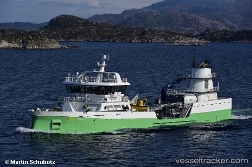
Vessel Ronja Tind IMO: 9743801, MMSI: 258053000 Live Fish Carrier
UTC, 69.67670, 18.98550, course: 227, speed: 0
UTC, 69.67670, 18.98549, course: 227, speed: 0
2026-01-18 10:21:59 UTC, 69.67672, 18.98542, course: 227, speed: 0
Live AIS position:
UTC. Near Tromsø),
updated 2026-01-18 10:21:59 UTC.
Find the position of the vessel Ronja Tind on the map. The latter are known coordinates and path.
marine traffic ship tracker show on live map
The current position of vessel Ronja Tind is 69.67672 lat / 18.98542 lng. Updated: 2026-01-18 10:21:59 UTCCurrently sailing under the flag of Norway
Details:
Last coordinates of the vessel:
UTC, 69.67671, 18.98544, course: 227, speed: 0UTC, 69.67670, 18.98550, course: 227, speed: 0
UTC, 69.67670, 18.98549, course: 227, speed: 0
2026-01-18 10:21:59 UTC, 69.67672, 18.98542, course: 227, speed: 0