 vesseltracker.com
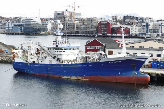
 Nordfisk
Current Status
Where is the vessel?
Nordfisk is currently in Near BODOE, based on AIS data received about 1h ago.
Latest AIS update:
Current position: 67.28897° N, 14.37131° E (Near BODOE)
Average speed (last 7 days): Loading…
Average speed (last 30 days): Loading…
Vessel profile: Nordfisk is a Fish Carrier with dimensions 64m x 13m.
This page combines live AIS, route history, probable destination signals, nearby traffic, and port activity for practical vessel monitoring.
The current position of vessel Nordfisk is 67.28897 lat / 14.37131 lng. Updated: 2026-04-07 01:25:39 UTCNearest reference points:
- Near Misten
- Near SVOLVAER
- Near Ørnes
Currently sailing under the flag of Norway ![]()
Nordfisk built in 2002 year
Details:
Live Vessel Nordfisk Analytics (details, animations, etc.)
Recent AIS points (UTC):
2026-04-06 19:40:41 UTC · 67.28895, 14.37133 · SOG 0 kn · COG 250°2026-04-06 21:46:46 UTC · 67.28895, 14.37133 · SOG 0 kn · COG 250°
2026-04-06 23:28:43 UTC · 67.28896, 14.37135 · SOG 0 kn · COG 250°
2026-04-07 01:25:39 UTC · 67.28897, 14.37131 · SOG 0 kn · COG 249°