 vesseltracker.com
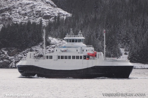
 Heroysund
Current Status
Where is the vessel?
Heroysund is currently in Near Stokkvågen, based on AIS data received about 1h ago.
Latest AIS update:
Current position: 66.33883° N, 13.00555° E (Near Stokkvågen)
Average speed (last 7 days): Loading…
Average speed (last 30 days): Loading…
Vessel profile: Heroysund is a Passenger Ro Ro Cargo Ship with dimensions 72m x 14m.
This page combines live AIS, route history, probable destination signals, nearby traffic, and port activity for practical vessel monitoring.
The current position of vessel Heroysund is 66.33883 lat / 13.00555 lng. Updated: 2026-03-30 20:02:17 UTCNearest reference points:
- Near Lurøy
- Near Vikholmen
- Near Tonnes
Currently sailing under the flag of Norway ![]()
Heroysund built in 2013 year
Deadweight:
360 tDetails:
Live Vessel Heroysund Analytics (details, animations, etc.)
Recent AIS points (UTC):
2026-03-30 13:49:38 UTC · 66.34425, 12.98765 · SOG 11.5 kn · COG 278°2026-03-30 15:29:33 UTC · 66.40155, 12.51846 · SOG 12.4 kn · COG 269°
2026-03-30 18:02:52 UTC · 66.34401, 12.93810 · SOG 11.7 kn · COG 94°
2026-03-30 20:02:17 UTC · 66.33883, 13.00555 · SOG 0 kn · COG 116°