 vesseltracker.com
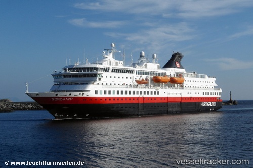
Nordkapp
Current StatusWhere is the vessel?
Nordkapp is currently in Near HENNINGSVAR, based on AIS data received about 1h ago.
Latest AIS update:
Current position: 68.11874° N, 14.11029° E (Near HENNINGSVAR)
Average speed (last 7 days): Loading…
Average speed (last 30 days): Loading…
Vessel profile: Nordkapp is a Passenger Ro Ro Cargo Ship with dimensions 18m x 123m.
This page combines live AIS, route history, probable destination signals, nearby traffic, and port activity for practical vessel monitoring.
The current position of vessel Nordkapp is 68.11874 lat / 14.11029 lng. Updated: 2026-03-25 19:34:01 UTCNearest reference points:
- Near SVOLVAER
- Near Berrvik (Bergvik)
- Near Misten
Details:
Live Vessel Nordkapp Analytics (details, animations, etc.)
Recent AIS points (UTC):
2026-03-25 14:14:52 UTC · 68.44304, 15.17111 · SOG 13.4 kn · COG 220°2026-03-25 15:48:50 UTC · 68.22168, 14.81932 · SOG 14.6 kn · COG 298°
2026-03-25 18:20:14 UTC · 68.23087, 14.56679 · SOG 0 kn · COG 349°
2026-03-25 19:34:01 UTC · 68.11874, 14.11029 · SOG 13.6 kn · COG 259°