 vesseltracker.com
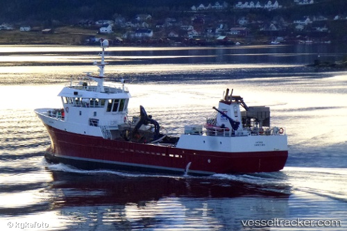
Viking Saga
Current StatusWhere is the vessel?
Viking Saga is currently in Near Vevang, based on AIS data received less than 1h ago.
Latest AIS update:
Current position: 63.05198° N, 7.44052° E (Near Vevang)
Average speed (last 7 days): Loading…
Average speed (last 30 days): Loading…
Vessel profile: Viking Saga is a Fish Carrier with dimensions 9m x 42m.
This page combines live AIS, route history, probable destination signals, nearby traffic, and port activity for practical vessel monitoring.
The current position of vessel Viking Saga is 63.05198 lat / 7.44052 lng. Updated: 2026-04-14 20:15:01 UTCNearest reference points:
- Near ELNESVAGEN
- Near Kristiansund
- Near Aukra
Details:
Live Vessel Viking Saga Analytics (details, animations, etc.)
Recent AIS points (UTC):
2026-04-14 13:35:54 UTC · 63.05199, 7.44050 · SOG 0 kn · COG 101°2026-04-14 15:50:55 UTC · 63.05198, 7.44049 · SOG 0 kn · COG 101°
2026-04-14 17:41:59 UTC · 63.05200, 7.44050 · SOG 0 kn · COG 100°
2026-04-14 20:15:01 UTC · 63.05198, 7.44052 · SOG 0 kn · COG 100°