 vesseltracker.com
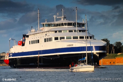
 Landegode
Current Status
Where is the vessel?
Landegode is currently in Near BODOE, based on AIS data received less than 1h ago.
Latest AIS update:
Current position: 67.28844° N, 14.39286° E (Near BODOE)
Average speed (last 7 days): Loading…
Average speed (last 30 days): Loading…
Vessel profile: Landegode is a Passenger Ro Ro Cargo Ship with dimensions 96m x 17m.
This page combines live AIS, route history, probable destination signals, nearby traffic, and port activity for practical vessel monitoring.
The current position of vessel Landegode is 67.28844 lat / 14.39286 lng. Updated: 2026-04-23 01:07:57 UTCNearest reference points:
- Near Misten
- Near SVOLVAER
- Near Ørnes
Currently sailing under the flag of Norway ![]()
Landegode built in 2012 year
Deadweight:
650 tDetails:
Live Vessel Landegode Analytics (details, animations, etc.)
Recent AIS points (UTC):
2026-04-22 21:45:54 UTC · 67.41406, 12.73139 · SOG 17.7 kn · COG 103°2026-04-22 22:04:05 UTC · 67.39684, 12.95140 · SOG 16.9 kn · COG 106°
2026-04-23 00:16:27 UTC · 67.28846, 14.39283 · SOG 0 kn · COG 274°
2026-04-23 01:07:57 UTC · 67.28844, 14.39286 · SOG 0 kn · COG 274°