 vesseltracker.com
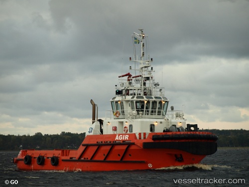
 Agirtug
Current Status
Where is the vessel?
Agirtug is currently in Near Halmstad, based on AIS data received about 1h ago.
Latest AIS update:
Current position: 56.66260° N, 12.85713° E (Near Halmstad)
Average speed (last 7 days): Loading…
Average speed (last 30 days): Loading…
Vessel profile: Agirtug is a Tug with dimensions 33m x 10m.
This page combines live AIS, route history, probable destination signals, nearby traffic, and port activity for practical vessel monitoring.
The current position of vessel Agirtug is 56.66260 lat / 12.85713 lng. Updated: 2026-04-08 17:40:58 UTCNearest reference points:
- Near Halmstad
- Near FALKENBERG
- Near Viken
Currently sailing under the flag of Sweden ![]()
Agirtug built in 2001 year
Details:
Live Vessel Agirtug Analytics (details, animations, etc.)
Recent AIS points (UTC):
2026-04-08 11:59:29 UTC · 56.66257, 12.85719 · SOG 0 kn · COG 22°2026-04-08 14:01:08 UTC · 56.66256, 12.85717 · SOG 0 kn · COG 23°
2026-04-08 16:13:09 UTC · 56.66259, 12.85711 · SOG 0 kn · COG 22°
2026-04-08 17:40:58 UTC · 56.66260, 12.85713 · SOG 0 kn · COG 23°