 vesseltracker.com
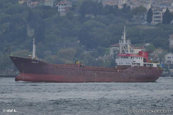
Vessel Banu S IMO: 8301060, MMSI: 271002040 General Cargo Ship
UTC, 40.96077, 28.53422, course: 266, speed: 7.5
UTC, 40.90657, 28.29349, course: 265, speed: 8.2
2026-01-19 09:49:13 UTC, 40.88197, 28.14839, course: 259, speed: 8.7
Live AIS position:
UTC. Near Marmara Ereglisi),
updated 2026-01-19 09:49:13 UTC.
Find the position of the vessel Banu S on the map. The latter are known coordinates and path.
marine traffic ship tracker show on live map
The current position of vessel Banu S is 40.88197 lat / 28.14839 lng. Updated: 2026-01-19 09:49:13 UTCCurrently sailing under the flag of Turkey
Details:
Last coordinates of the vessel:
UTC, 40.96578, 28.55226, course: 266, speed: 6.8UTC, 40.96077, 28.53422, course: 266, speed: 7.5
UTC, 40.90657, 28.29349, course: 265, speed: 8.2
2026-01-19 09:49:13 UTC, 40.88197, 28.14839, course: 259, speed: 8.7