 vesseltracker.com
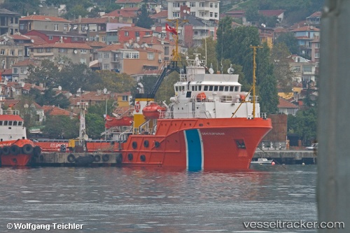
Vessel Gemikurtaran IMO: 8119041, MMSI: 271002272 Offshore Tug Supply Ship
UTC, 40.87278, 28.35563, course: 260, speed: 10.4
UTC, 40.82500, 27.93667, course: -1, speed: 10
2026-02-03 23:48:55 UTC, 40.77537, 27.59503, course: 235, speed: 9.8
Live AIS position:
UTC. Near Saraylar),
updated 2026-02-03 23:48:55 UTC.
Find the position of the vessel Gemikurtaran on the map. The latter are known coordinates and path.
marine traffic ship tracker show on live map
The current position of vessel Gemikurtaran is 40.77537 lat / 27.59503 lng. Updated: 2026-02-03 23:48:55 UTCCurrently sailing under the flag of Turkey
Gemikurtaran built in 1984 year
Deadweight:
1304 tDetails:
Last coordinates of the vessel:
UTC, 40.96717, 28.77148, course: 350, speed: 0UTC, 40.87278, 28.35563, course: 260, speed: 10.4
UTC, 40.82500, 27.93667, course: -1, speed: 10
2026-02-03 23:48:55 UTC, 40.77537, 27.59503, course: 235, speed: 9.8