 vesseltracker.com
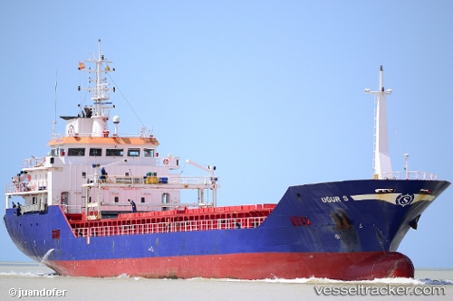
Vessel Ugurs IMO: 9539793, MMSI: 271040150 General Cargo Ship
UTC, 40.64667, -8.72667, course: -1, speed: 0
UTC, 40.64667, -8.72667, course: -1, speed: 0
2026-01-20 01:34:45 UTC, 40.64667, -8.72833, course: -1, speed: 0
Live AIS position:
UTC. Near Gafanha da Nazaré),
updated 2026-01-20 01:34:45 UTC.
Find the position of the vessel Ugurs on the map. The latter are known coordinates and path.
marine traffic ship tracker show on live map
The current position of vessel Ugurs is 40.64667 lat / -8.72833 lng. Updated: 2026-01-20 01:34:45 UTCCurrently sailing under the flag of Turkey
Ugurs built in 2010 year
Deadweight:
4406 tDetails:
Last coordinates of the vessel:
UTC, 40.64667, -8.72833, course: -1, speed: 0UTC, 40.64667, -8.72667, course: -1, speed: 0
UTC, 40.64667, -8.72667, course: -1, speed: 0
2026-01-20 01:34:45 UTC, 40.64667, -8.72833, course: -1, speed: 0