 vesseltracker.com
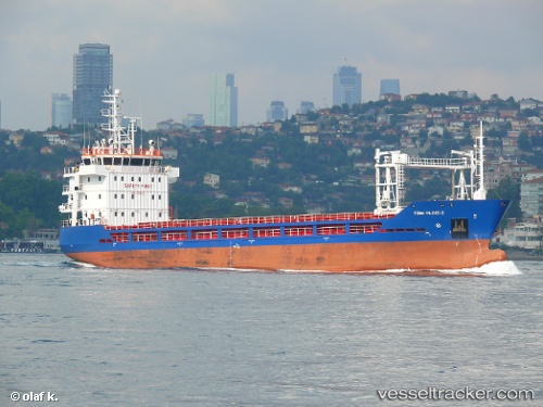
Vessel Turk Yildizi 2 IMO: 9703021, MMSI: 271043811 General Cargo Ship
UTC, 41.68895, 41.67217, course: 54, speed: 0.1
UTC, 41.68899, 41.67213, course: 57, speed: 0
2026-01-27 16:16:03 UTC, 41.68906, 41.67201, course: 63, speed: 0
Live AIS position:
UTC. Near Batumi),
updated 2026-01-27 16:16:03 UTC.
Find the position of the vessel Turk Yildizi 2 on the map. The latter are known coordinates and path.
marine traffic ship tracker show on live map
The current position of vessel Turk Yildizi 2 is 41.68906 lat / 41.67201 lng. Updated: 2026-01-27 16:16:03 UTCCurrently sailing under the flag of Turkey
Details:
Last coordinates of the vessel:
UTC, 41.68899, 41.67233, course: 46, speed: 0UTC, 41.68895, 41.67217, course: 54, speed: 0.1
UTC, 41.68899, 41.67213, course: 57, speed: 0
2026-01-27 16:16:03 UTC, 41.68906, 41.67201, course: 63, speed: 0