 vesseltracker.com
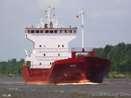
Vessel Ym Hazar IMO: 9103738, MMSI: 271044021 Multi Purpose Carrier
UTC, 39.65812, 26.06648, course: 9, speed: 8.7
UTC, 39.86192, 26.05005, course: 317, speed: 0.1
2026-01-28 06:00:11 UTC, 39.86216, 26.05018, course: 289, speed: 0.1
Live AIS position:
UTC. Near Bozcaada),
updated 2026-01-28 06:00:11 UTC.
Find the position of the vessel Ym Hazar on the map. The latter are known coordinates and path.
marine traffic ship tracker show on live map
The current position of vessel Ym Hazar is 39.86216 lat / 26.05018 lng. Updated: 2026-01-28 06:00:11 UTCCurrently sailing under the flag of Turkey
Ym Hazar built in 1995 year
Deadweight:
3200 tDetails:
Last coordinates of the vessel:
UTC, 39.46500, 26.03833, course: -1, speed: 9UTC, 39.65812, 26.06648, course: 9, speed: 8.7
UTC, 39.86192, 26.05005, course: 317, speed: 0.1
2026-01-28 06:00:11 UTC, 39.86216, 26.05018, course: 289, speed: 0.1