 vesseltracker.com
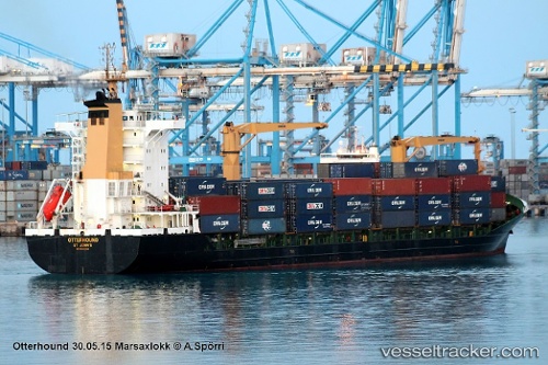
Vessel Med Tekirdag IMO: 9265598, MMSI: 271044212 Container Ship
UTC, 40.90269, 27.47108, course: 201, speed: 0
UTC, 40.90269, 27.47109, course: 201, speed: 0
2026-01-28 00:30:42 UTC, 40.88070, 27.61509, course: 95, speed: 13.9
Live AIS position:
UTC. Near BARBAROS),
updated 2026-01-28 00:30:42 UTC.
Find the position of the vessel Med Tekirdag on the map. The latter are known coordinates and path.
marine traffic ship tracker show on live map
The current position of vessel Med Tekirdag is 40.88070 lat / 27.61509 lng. Updated: 2026-01-28 00:30:42 UTCCurrently sailing under the flag of Turkey
Med Tekirdag built in 2003 year
Deadweight:
13760 tDetails:
Last coordinates of the vessel:
UTC, 40.90266, 27.47106, course: 201, speed: 0.1UTC, 40.90269, 27.47108, course: 201, speed: 0
UTC, 40.90269, 27.47109, course: 201, speed: 0
2026-01-28 00:30:42 UTC, 40.88070, 27.61509, course: 95, speed: 13.9