 vesseltracker.com
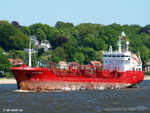
Vessel TOMRIS E IMO: 9228588, MMSI: 271048139 Chemical/Oil Products Tanker
UTC, 40.95686, 28.75629, course: 56, speed: 0.1
UTC, 40.95717, 28.75608, course: 81, speed: 0
2026-02-28 23:32:16 UTC, 40.95689, 28.75627, course: 55, speed: 0.1
Live AIS position:
UTC. Near Küçükçekmece),
updated 2026-02-28 23:32:16 UTC.
Find the position of the vessel TOMRIS E on the map. The latter are known coordinates and path.
marine traffic ship tracker show on live map
The current position of vessel TOMRIS E is 40.95689 lat / 28.75627 lng. Updated: 2026-02-28 23:32:16 UTCCurrently sailing under the flag of Turkey
TOMRIS E built in 2001 year
Deadweight:
4454 tDetails:
Last coordinates of the vessel:
UTC, 40.95708, 28.75607, course: 70, speed: 0.1UTC, 40.95686, 28.75629, course: 56, speed: 0.1
UTC, 40.95717, 28.75608, course: 81, speed: 0
2026-02-28 23:32:16 UTC, 40.95689, 28.75627, course: 55, speed: 0.1