 vesseltracker.com
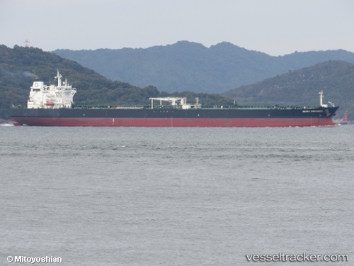
Vessel T.KURUCESME IMO: 9692478, MMSI: 271051145 Crude Oil Tanker
UTC, 37.11596, 15.26724, course: 49, speed: 0
UTC, 37.11599, 15.26725, course: 49, speed: 0
2026-01-27 22:06:12 UTC, 37.11597, 15.26726, course: 49, speed: 0
Live AIS position:
UTC. Near SANTA PANAGIA),
updated 2026-01-27 22:06:12 UTC.
Find the position of the vessel T.KURUCESME on the map. The latter are known coordinates and path.
marine traffic ship tracker show on live map
The current position of vessel T.KURUCESME is 37.11597 lat / 15.26726 lng. Updated: 2026-01-27 22:06:12 UTCCurrently sailing under the flag of Turkey
T.KURUCESME built in 0 year
Deadweight:
0 tDetails:
Last coordinates of the vessel:
UTC, 37.11597, 15.26727, course: 49, speed: 0UTC, 37.11596, 15.26724, course: 49, speed: 0
UTC, 37.11599, 15.26725, course: 49, speed: 0
2026-01-27 22:06:12 UTC, 37.11597, 15.26726, course: 49, speed: 0