 vesseltracker.com
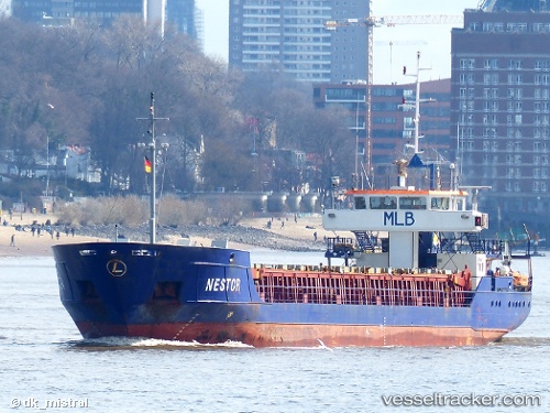
 Nestor
Current Status
Where is the vessel?
Nestor is currently in Near MAASVLAKTE - ROTTERDAM, based on AIS data received about 5h ago.
Latest AIS update:
Current position: 51.93426° N, 4.05515° E (Near MAASVLAKTE - ROTTERDAM)
Average speed (last 7 days): Loading…
Average speed (last 30 days): Loading…
Vessel profile: Nestor is a Multi Purpose Carrier with dimensions 90m x 12m.
This page combines live AIS, route history, probable destination signals, nearby traffic, and port activity for practical vessel monitoring.
The current position of vessel Nestor is 51.93426 lat / 4.05515 lng. Updated: 2026-04-10 07:27:48 UTCNearest reference points:
- Near MAASVLAKTE - ROTTERDAM
- Near HOEK VAN HOLLAND
- Near Rockanje
Currently sailing under the flag of Antigua Barbuda ![]()
Nestor built in 2000 year
Deadweight:
2500 tDetails:
Live Vessel Nestor Analytics (details, animations, etc.)
Recent AIS points (UTC):
2026-04-10 02:24:02 UTC · 52.23554, 3.78298 · SOG 6.3 kn · COG 191°2026-04-10 03:49:32 UTC · 52.10168, 3.78470 · SOG 9.3 kn · COG 185°
2026-04-10 05:57:58 UTC · 51.93684, 4.06231 · SOG 7.4 kn · COG 243°
2026-04-10 07:27:48 UTC · 51.93426, 4.05515 · SOG 0 kn · COG 66°