 vesseltracker.com
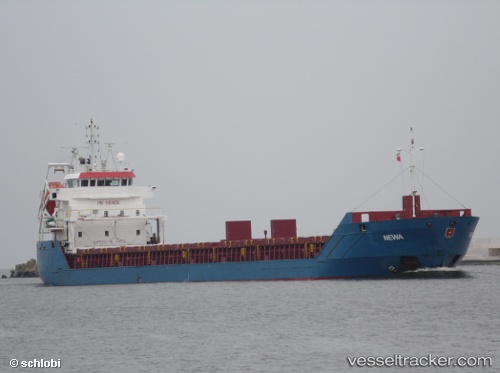
 KILLU
KILLU
Current Status
Where is the vessel?
KILLU is currently in Near Molengat, based on AIS data received about 18h ago.
Latest AIS update:
Current position: 53.18445° N, 4.53728° E (Near Molengat)
Average speed (last 7 days): Loading…
Average speed (last 30 days): Loading…
Vessel profile: KILLU is a General Cargo with dimensions 114.4m x 15m.
This page combines live AIS, route history, probable destination signals, nearby traffic, and port activity for practical vessel monitoring.
The current position of vessel KILLU is 53.18445 lat / 4.53728 lng. Updated: 2026-04-10 07:27:38 UTCNearest reference points:
- Near Molengat
- Near de Waal
- Near Den Helder
Currently sailing under the flag of Antigua Barbuda ![]()
KILLU built in 2009 year
Deadweight:
6050 tDetails:
Live Vessel KILLU Analytics (details, animations, etc.)
Recent AIS points (UTC):
2026-04-10 02:24:08 UTC · 52.54321, 3.78359 · SOG 8.9 kn · COG 40°2026-04-10 03:48:07 UTC · 52.69663, 4.02500 · SOG 9.3 kn · COG 43°
2026-04-10 05:58:08 UTC · 52.97458, 4.36158 · SOG 9.8 kn · COG 23°
2026-04-10 07:27:38 UTC · 53.18445, 4.53728 · SOG 9.4 kn · COG 28°