 vesseltracker.com
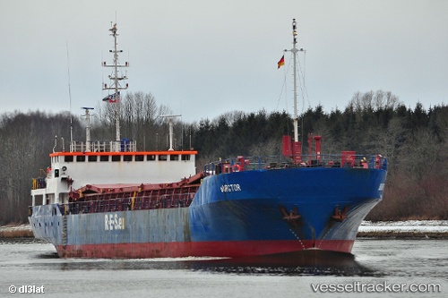
 Burgtor
Current Status
Where is the vessel?
Burgtor is currently in Near Saint Nicolas, based on AIS data received about 2h ago.
Latest AIS update:
Current position: 38.35506° N, 22.66215° E (Near Saint Nicolas)
Average speed (last 7 days): Loading…
Average speed (last 30 days): Loading…
Vessel profile: Burgtor is a Multi Purpose Carrier with dimensions 87m x 13m.
This page combines live AIS, route history, probable destination signals, nearby traffic, and port activity for practical vessel monitoring.
The current position of vessel Burgtor is 38.35506 lat / 22.66215 lng. Updated: 2026-03-30 23:39:05 UTCNearest reference points:
- Near AGIOI THEODORI
- Near Náfplion
- Near Amaliápolis
Currently sailing under the flag of Antigua Barbuda ![]()
Burgtor built in 1989 year
Deadweight:
3432 tDetails:
Live Vessel Burgtor Analytics (details, animations, etc.)
Recent AIS points (UTC):
2026-03-30 17:45:13 UTC · 38.35636, 22.66305 · SOG 0.3 kn · COG 242°2026-03-30 19:45:00 UTC · 38.35618, 22.66288 · SOG 0.1 kn · COG 251°
2026-03-30 21:21:02 UTC · 38.35490, 22.66178 · SOG 0.1 kn · COG 359°
2026-03-30 23:39:05 UTC · 38.35506, 22.66215 · SOG 0 kn · COG 336°