 vesseltracker.com
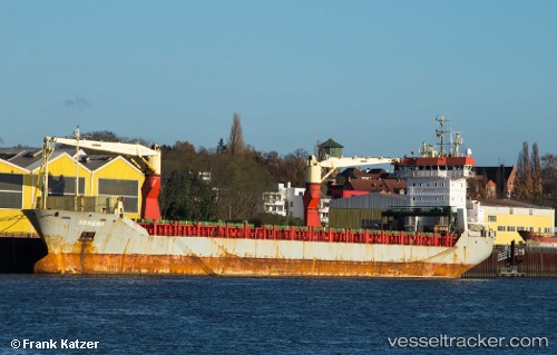
Vessel Marmolokai IMO: 9294977, MMSI: 304676000 Multi Purpose Carrier
UTC, 28.89888, -93.98247, course: 126, speed: 12.8
UTC, 28.64333, -93.58219, course: 131, speed: 12.7
2026-01-29 17:56:56 UTC, 28.43400, -93.24439, course: 125, speed: 13.2
Live AIS position:
UTC. 81 nm S of Cameron),
updated 2026-01-29 17:56:56 UTC.
Find the position of the vessel Marmolokai on the map. The latter are known coordinates and path.
marine traffic ship tracker show on live map
The current position of vessel Marmolokai is 28.43400 lat / -93.24439 lng. Updated: 2026-01-29 17:56:56 UTCCurrently sailing under the flag of Antigua Barbuda
Marmolokai built in 2004 year
Deadweight:
10649 tDetails:
Last coordinates of the vessel:
UTC, 29.19867, -94.50475, course: 136, speed: 12.8UTC, 28.89888, -93.98247, course: 126, speed: 12.8
UTC, 28.64333, -93.58219, course: 131, speed: 12.7
2026-01-29 17:56:56 UTC, 28.43400, -93.24439, course: 125, speed: 13.2